


The State of Tabasco is a destination of great significance for both national and international tourism, as it is considered the birthplace of the Olmec Culture. With the gradual return to normalcy, tourism is also beginning to pick up again, with visitors eager to learn more about the rich cultural heritage of the region. Tabasco boasts a total of eight major archaeological zones, which are spread throughout the state’s territory.
Comalcalco, La Venta, Malpasito, Pomoná, Moral Reforma, Santa Elena, San Claudio, and Panhalé are the eight most important archaeological sites in Tabasco, each with their own unique characteristics and historical significance. While some of these sites may be more well-known than others, all of them are considered important for those interested in exploring the state’s pre-Hispanic past.
The municipalities of Comalcalco, Huimanguillo, Balancán, and Tenosique are particularly rich in Olmec culture, although there are other areas within the state that also have important historical sites to discover. The people of Tabasco take great pride in their pre-Columbian heritage, and this is reflected in the presence of monuments such as the one dedicated to the mythical cacique Tabascob, who gave the state its name.
The region was first explored by the Spanish in 1518, when Captain Juan de Grijalva arrived at the mouth of the river that would come to be known as the Tabasco River. Today, many of the state’s archaeological zones remain unexplored, offering a promising future for further research into Tabasco’s pre-Hispanic past.
One such site that is open to the public is Comalcalco, a city known for its unique brick architecture and beautifully decorated stucco models. The city was located in an area that was highly productive for cocoa cultivation, and its proximity to the Gulf of Mexico allowed for cultural and political exchange with other Mayan cities of the Classic period, such as Palenque. The Olmecs, who were only discovered by the modern world in the early 20th century, have also left a significant mark on the region.
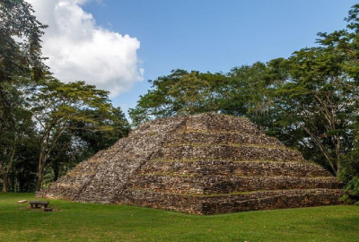
The formal explorations at the important metropolis of La Venta, near the Tonalá river, marked the discovery of a cultural complex where it is evident that this early Mesoamerican society possessed advanced urban planning concepts, as evidenced by the city’s north-south orientation, which deviates 17 degrees to the west for astronomical reasons.
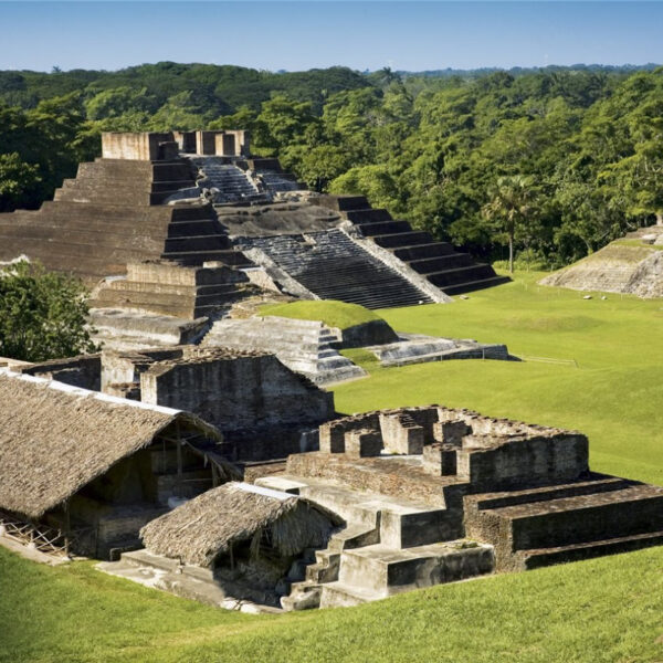
Comalcalco
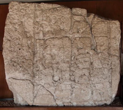
Comalcalco is an ancient Mayan archaeological site located in the municipality of Comalcalco in the Mexican state of Tabasco. It is situated about 60 km from Villahermosa and is considered to be the westernmost Mayan site. The site was originally known as Joy Chan, which translates to “Surrounded Sky” in Mayan. The ruins at Comalcalco date back to the Classic Maya period, from the 1st century BC to the 9th century AD, and consist of a necropolis built with bricks and oyster shell stucco.
The location of Comalcalco is in the central area of Chontalpa, on the east bank of the Seco River, among the remains of what was once an immense tropical forest. The most notable feature of Comalcalco is the use of bricks in its construction, which is a result of the lack of stone materials in the region.
The pre-Hispanic settlement covers an area of 72 hectares (7 km²) and includes various architectural groups and construction systems, such as foundations made of compacted earth covered with flattened lime oyster shell and brick masonry constructions. The buildings were decorated with stucco models that were also painted in colors such as red, blue, green, yellow, and black, in order to conceal the bricks.
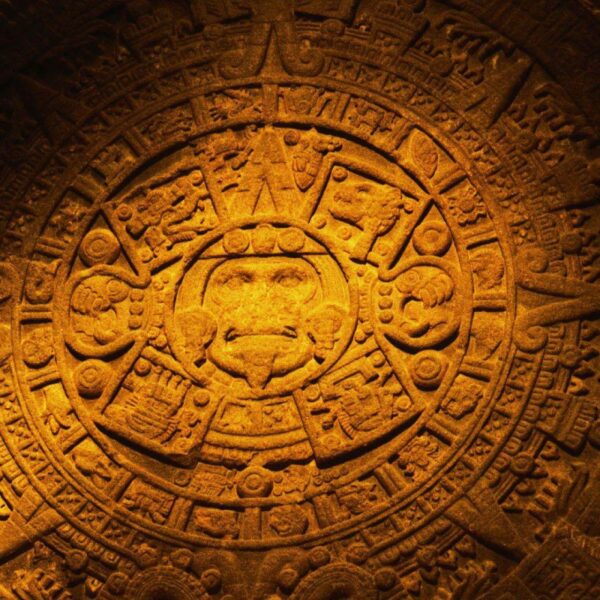
In June 2011, the National Institute of Anthropology and History (INAH) announced the discovery of what could be the first Mayan cemetery, with a total of 116 funerary burials over a thousand years old, located in three mounds on the periphery of the city. In November 2011, the INAH also announced the finding of a second Mayan inscription announcing the famous prophecy of the end of an era of the Mayan calendar, on the mythical date of December 21, 2012, in a piece known as the “Brick of Comalcalco”.
The site was first made known by the French explorer Désiré Charnay who visited the site from September 12 to 22, 1880, and published several articles about it in the North American Review magazine between 1880 and 1882, as well as in his book “Les anciennes villes du Nouveau Monde” in 1885. Since then, Comalcalco has been visited by numerous travelers such as Frans Blom and Oliver La Farge in 1925.
Although some excavations were made in 1892, it was not until 1956 that investigations began by Mexican and North American specialists such as Ekholm, Román Pina Chan, Andrews, and Peniche.
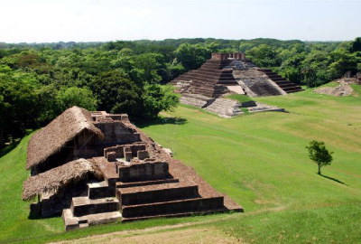
Moral-Reforma
The Moral-Reforma Archaeological Zone is an ancient Mayan site from the Classic period. It can be found in the municipality of Balancán, in the Mexican state of Tabasco, on the floodplains of the San Pedro Mártir River near its mouth in the Usumacinta River. It is located 15 km west of El Triunfo, 20 km east of Balancán de Domínguez, and 35 km northeast of Tenosique de Pino Suárez.
The site is part of a group of Mayan cities in the Usumacinta basin, such as Pomoná, San Claudio, Palenque, Bonampak, Yaxchilán and Piedras Negras. It is similar to Tikal in Guatemala and Río Bec in Campeche. The Mayan city, known as Moral-Reforma, was a fluvial port that reached its peak around 600 AD. The site, located next to the rural community of Reforma, has an area of 87 hectares and at least 30 mounds, some of which may cover large pyramids. It was opened to the public in October 2009.
The original name of the city is unknown, despite the presence of an emblematic Glyph on Stela 1, which is illegible. The site has been referred to by various names over the years, including “La Reforma II,” “Moral,” “Morales,” and “Acalán,” before being given its current name in 1993 by archaeologist Daniel Juárez of the National Institute of Anthropology and History.
The first reference to the site was made by archaeologist Teobert Maler in 1907, when he heard stories from locals about large mounds of earth on the site during an expedition. The eastern region of Tabasco, where the site is located, was politically divided into several cities of modest rank, including Pomoná, San Claudio, Santa Elena, and Moral-Reforma.
Pomoná is the best-known of these sites, but Santa Elena and Moral-Reforma are also significant. The three sites had complex networks of relations with neighboring cities, such as Palenque, Piedras Negras, and more distant sites like Toniná, Yaxchilán, Calakmul, and Tikal. The city of Moral-Reforma existed a thousand years before the arrival of the Spanish and had its heyday between 622 and 756 AD, under the rule of the so-called king of Moral.
The city was used for agriculture and commerce through the rivers San Pedro Mártir and Usumacinta. The city had a long history, with settlement beginning in 300 BC and abandonment in 1000 AD. Initially, the city began as a village-type settlement but gradually gained importance as a traffic control center on the San Pedro Mártir river, facilitating communication and the exchange of goods between Mayan peoples in the Guatemalan Petén and those on the Gulf of Mexico.
Its strategic location made it a target for powerful neighboring cities such as Palenque and the Calakmul-Piedras Negras axis, which sought to control it for many years. t is known that Moral Reforma made political alliances with the domains of Calakmul (Kaan) in the year 662 and with Palenque (Lakam Ha) in the year 690 AD. C., for later around 750 d. C. become the head of a small independent province in the region of the San Pedro Mártir river.
Malpasito
Malpasito is a historical site that was located at the confluence of the states of Chiapas, Veracruz, and Tabasco. The site was occupied by groups of Zoque affiliation between 600 and 900 AD and was home to a modest city that served as the political and economic center of a small province that stretched between the La Pava and Amacoite mountain ranges.
The site was a point of cohesion for smaller settlements located on the slopes of the mountain fronts, and its humid tropical climate favored an abundance of natural resources and good conditions for corn and cocoa crops. The inhabitants of Malpasito were known for their pottery tradition, which featured white or cream finishes and innovations acquired from the coast of the Gulf of Mexico, such as fine orange ceramics, which were adapted and developed locally.
It is believed that Malpasito was subject to more important sites located in the northwest of Chiapas, such as San Antonio and San Isidro, with which it shares cultural traits in terms of ceramics and architecture. The settlers of these sites were possibly the ancestors of the Zoque cacicazgo from Quechula, which were found by the Spanish conquistadors.
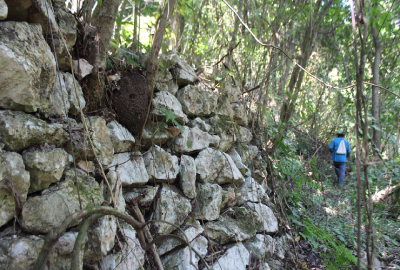
The archaeological zone of Malpasito has a strategic location on the slope of the mountain and between two ravines that delimit the only access in the extreme northeast. The monumental part of the site occupies an area of 14 hectares and features 53 buildings. The architecture is distinguished by the use of rectangular platforms built with carved sandstone rocks and joined with mortar.
In the civic-ceremonial area, these constructions were distributed in a planned manner, both on the top and on the cambers of artificial terraces, which implied the management of engineering knowledge to integrate the architectural elements into the physiographic landscape. In the residential area, on the other hand, the location of the buildings was determined by the relief, the water sources, and the easy access to the agricultural spaces.
For this reason, low hills were chosen, as observed in the northern part of the site. These platforms possibly supported houses or temples covered with high truncated conical roofs, built with perishable materials such as wood and some type of guano or grass. The site of Malpasito is an important historical site that provides insight into the cultural, architectural, and agricultural practices of the ancient inhabitants of the region.
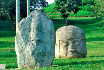
La Venta
The Olmec city is considered to be the oldest known civilization in Mesoamerica, characterized by its planned layout and monumental architecture. The city was made up of platforms that were aligned on axes from north to south to create avenues and open spaces. It is believed that the city began to be populated around 5000 BC and that by 600 years later, it had already developed a highly advanced culture.
The large structures in the city were made of compacted earth, which was a remarkable achievement given that the quarries for this material were located far away. Additionally, tar was used in the construction of these structures, which rose up to 30 meters on spacious terraces. One of the most impressive features of the Olmec city are the monumental stone sculptures, some of which weigh up to 35 tons.
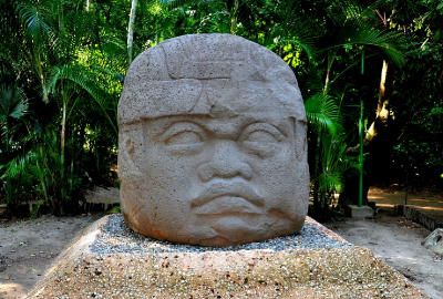
These sculptures were brought from far away, specifically from the Gulf of Mexico area, and were carved with extraordinary mastery to recreate the human figure or combinations of it with that of animals in order to capture fantastic beings. The Olmecs also left very copious underground offerings in which jade abounds, making it a unique example in ancient Mexico from that time.
It is believed that the Olmec city was home to a complex and likely hierarchical society that sustained itself through the intense cultivation of maize and cassava, which the Olmecs domesticated relatively early and obtained up to three annual harvests. They knew how to take advantage of the richness of the very humid alluvial soils and the abundant water deposits and currents, specifically the Tonalá River and its tributaries, as well as an ecosystem rich in edible plants and animals.
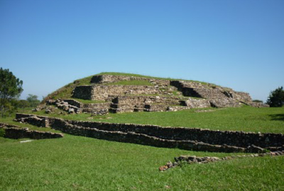
Around 400 B.C., the original extension of the site was estimated to be 200 hectares. The precious vestiges of the city are grouped into four complexes, each with its own unique characteristics. Complex A corresponds to the ceremonial enclosure, whose northern patio limits a series of basalt columns. Complex B is a vast ceremonial space on an impressive platform, to the north of which is the Stirling Acropolis.
Complex C contains the highest pyramidal base, the Great Pyramid, in which six splendid sculptures of fantastic beings were discovered. Complex D consists of more than 20 platforms, on one of which were found two sculptures known as “altars”, also of excellent quality.In 1955, when excavating on the north platform, the archaeologist Eduardo Contreras found a rich offering made up of 16 figurines of male individuals, all carved in different green stones and framed by a row of axes.
This find, known as Offering 4 from La Venta, commemorated a political-religious event that occurred approximately 1,300 years ago and is currently on display at the National Museum of Anthropology.A visit to the Olmec city is made even more enriching by the Site Museum, which complements the visit with the exhibition and explanation of more than 200 original stone, ceramic or jade objects, as well as dioramas and models made by experts.
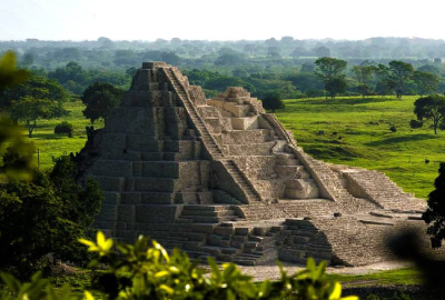
Pomoná
The Pomoná archaeological zone, also known as Pakbul according to hieroglyphic inscriptions, is a crucial location for understanding the adaptations and way of life of the Maya during the Classic period. This site, located in a geographic transition area between highlands and plains, played a significant role in the sociopolitical development of the Maya people.
The diverse and significant monuments with inscriptions found at Pomoná provide valuable insights into the political relationships of the Mayan civilization, specifically with powerful lordships such as Palenque.
Between 600 and 800 AD, Pomoná emerged as an independent political entity and its strategic geographical position allowed it to play a leading role in cultural exchange between the contemporary sites of the upper and lower Usumacinta. This led to dependencies on sites such as Panjalé, Boca del Cerro, and Chinikihá, as well as territorial conflicts with lordships such as Palenque, Piedras Negras, and La Mar.
The Pomoná site covers an area of approximately 190 hectares, characterized by hills located near the left bank of the Usumacinta River, which marks the border between the northern sierra of Chiapas and the Tabasco plain. The urban layout is dispersed, with six major architectural sets located on non-floodable high ground. So far, only Set 1 has been investigated.
Some of the most notable finds at Pomoná include the tombstone of the scribe, a stela with a high dignitary, a mask of the sun-jaguar god of the underworld, eccentric flint knives, a bust of a Mayan character, carved tombstones from Building 4, and a figure of an old man with a beard and a hat. These artifacts can be viewed at the Pomoná Site Museum.
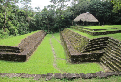
San Claudio
It is a unique and fascinating ancient Maya site that has been extensively studied by archaeologists and researchers. This site is known for its rich history and cultural significance. The site is believed to have been occupied by the ancient Maya civilization between the Late Classic and Terminal Classic periods (600-900 AD).
The Maya civilization was one of the most advanced and sophisticated ancient cultures in the Americas, known for their impressive architecture, advanced astronomical knowledge, and complex writing system. The first explorations in San Claudio, carried out in 1997, partially exposed a pyramidal structure approximately 12 meters high and a habitation platform, both in the sector closest to the lagoon.
The Mayan city of San Claudio, like other towns in the San Pedro Mártir River region, managed to develop a complementary economy based on the exploitation and commercialization of obsidian and flint, achieving an important commercialization network with other Mayan cities in the region.
Hundreds of flint objects were found in San Claudio, both in the form of finished and used products, as well as objects discarded in some of its production stages; however, the most voluminous finding was a deposit of used carving waste. as filler in front of a pyramidal base.
On the site, 94 stone constructions were located, scattered over a 70-hectare space, consisting of pyramidal bases, platforms, and a ball court distributed in five architectural groups, located on a succession of low hills that separate the wide flood plain. of the sierra. Likewise, 35 funerary burials have been discovered with an orientation of 11° northeast, which is the general arrangement that the ancient city presents. From these, some of the customs of its ancient inhabitants are known , which in general correspond to pre-Hispanic Mayan traditions.
In the formal architecture of the site, the construction of residential buildings organized around rectangular patios with restricted access predominates, although there are also structures of a ritual nature, such as some temples and a ball game court.
The most recent discovery is the possible pre-Hispanic observatory, located on the mound of Structure 12. This structure is a common basement 2.5 meters high that, in turn, has two other slightly higher ones at the north and south ends.
Panhalé
Panhalé, or also called Panjalé, is an archaeological site of the pre-Columbian Mayan culture located in the municipality of Tenosique in the Mexican state of Tabasco.
This Mayan city located in the eastern part of the state of Tabasco, belongs to the cities of the Usumacinta basin, like Pomoná, Moral Reforma, Palenque, Bonampak, Yaxchilan and Piedras Negras, and belongs to the group of populations of medium importance, to the like its neighbors Pomoná, Santa Elena and San Claudio.
The archaeological site of Panhalé, a Mayan word meaning “reflection of water”, is located on the banks of the Usumacinta River, on the top of a hill, about 5 km from the city of Tenosique de Pino Suárez. It is located on the right edge of the Boca del Cerro canyon, which is the last mountain that the Usumacinta River crosses before exiting the Tabasco plain.
Panhalé, has several structures and the so-called Stela I was found on the site, dating from around 830 AD. C. in which the glyph of the neighboring Mayan city of Pomoná is observed.
he importance of Panhalé in pre-Hispanic times consisted of serving as a viewpoint and checkpoint. From this place, the Mayans controlled the passage of the boats that transited through the waters of the Usumacinta River.
Due to the strategic nature of the Boca del Cerro canyon to control the passage of goods and people, many were the Mayan cities that tried to exercise their dominance over this point. The glyphs-emblems found in the cities of Palenque, Toniná, Piedras Negras and La Mar are found in war contexts, which suggests that the cities waged constant wars to control the strategic passage of the Usumacinta in the Boca del Cerro canyon.
This point functioned as a fluvial gate that connected the sites of the coastal plain of the Gulf with those of the upper Usumacinta and its numerous tributaries that descend from the Cuchumatanes, the highlands of Chiapas, the Guatemalan Petén and the Mayan mountains of Belize.
Santa Elena
Santa Elena (in Mayan: Wak’aab’-[h]a’) is an archaeological site belonging to the pre-Columbian Mayan culture, located in the municipality of Balancán, in the Mexican state of Tabasco. Santa Elena belongs to the cities of the Usumacinta basin, like Pomoná, Moral Reforma, Palenque, Bonampak, Yaxchilan and Piedras Negras.
It is located to the east of Tabasco, and it was a population of medium importance, together with its neighbors Pomoná, Moral Reforma and San Claudio, with whom it practiced an intense commercial exchange. Currently, Santa Elena is an archaeological zone that is being explored by the INAH, so the site is closed to the public.
The royal title, or emblem glyph, of this Mayan city was recently identified by David Stuart, so it is known that the original name was Wak’aab’-[h]a’ and it was the capital of the manor of the same name. The modern name refers to the population of the same name that is closest to the archaeological site.
The archaeological site of Santa Elena is located on the left bank of the San Pedro Mártir river, 95 kilometers southeast of the city of Balancán de Domínguez, municipal seat of Balancán, in the east of the state of Tabasco, near the community of La Asunción, in the limits of the municipality of Tenosique, which led to a dispute between the two municipalities over the location of the archaeological site.
This archaeological settlement is at a comparative level with other Mayan sites, especially in architecture, sculpture, monuments and extension, since it has monumental buildings whose architectural features can be identified masonry walls, rafters, stairs, patios, stepped platforms and a ball game in which there were glyphic tombstones attached to the interior slopes.
During the explorations carried out in the 70s, in these “cuyos” (mounds), four stelae made of limestone rock were found, “Palencano” style, all presenting glyphs on the front, three of these were found attached to the ball court, and to protect them from looting they were moved in 1986 to the “Dr. José Gómez Panaco” museum in the city of Balancán de Domínguez.
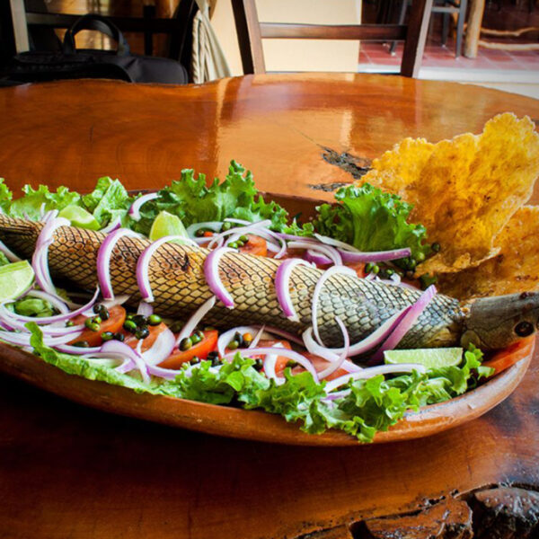
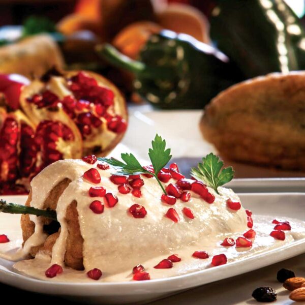
Gastronomy of Tabasco
The gastronomy of Tabasco is a reflection of the diverse cultures that have influenced the region throughout its history. From the indigenous Maya and Olmec people to the Spanish colonizers, the flavors of Tabasco have been shaped by a unique blend of ingredients and techniques.… Read More

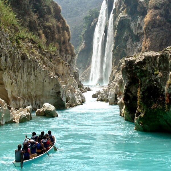
Beaches in Tabasco
The state is home to a wide variety of beaches, each offering a unique experience for visitors. From secluded coves to bustling beaches, Tabasco has something to offer for everyone.… Read More
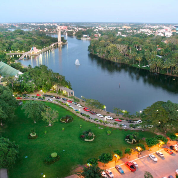
Villahermosa
Known for its lush tropical forests and diverse wildlife, Villahermosa is a popular destination for tourists looking to experience the unique culture and natural beauty of Mexico.… Read More
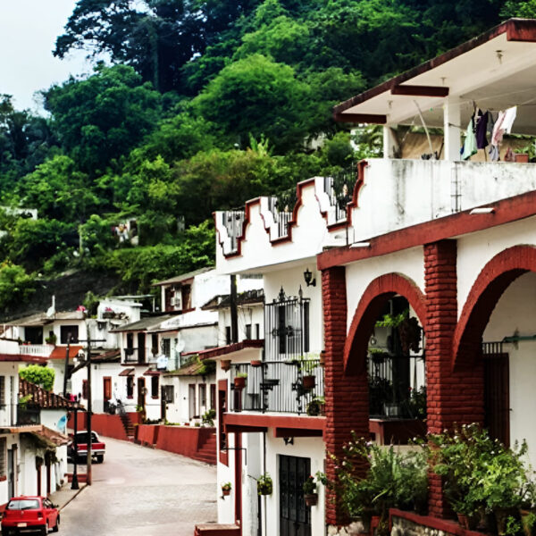
Magical Towns in Tabasco – Tapijulapa
The Magical Town in Tabasco, Tapijulapa, is considered an important destination for both national and international tourists, and is recognized for its natural beauty, traditional customs, and unique attractions.… Read More
Comalcalco
A city located 56 kilometers northwest of Villahermosa, well-known for its Mayan archaeological site on its outskirts, which boasts impressive ruins from the 1st century AD, belonging to the classical era of the Mayan civilization.… Read More

Traditions in Mexico
It is practically impossible to make a meticulous, and above all, accurate selection of the places to visit in Mexico. Each place that our country houses is unique and beautiful in its own way. Mexico, with its nearly 2 million km², has a large number of scenarios to offer, as well as endless activities to do. Do not lose your way and enter the places to visit in Mexico. In Mexico, apart from the beaches and its famous archaeological sites, there are many other really interesting sites and activities that you should know. In the surroundings of the main cities you will find places full of culture and tradition, where you can spend relaxing, interesting and fun vacations. On your trip through Mexico you cannot stop obtaining souvenirs, the crafts that are made here are of the highest quality and recognized worldwide. A shopping tour cannot be missed.… Read More

Beaches
On the Beaches of Mexico you can immerse yourself in the intense blue ocean of the Pacific bays, sunbathe on the shore of the warm and transparent waves of the Caribbean Sea in Quintana Roo or even rest on the beautiful coasts of the Gulf of Mexico. Mexican beaches hide wonderful secrets for the traveler. By visiting them, in addition to enjoying the excellent climate and water activities, you can discover splendid archaeological sites and interesting colonial cities without traveling long distances.… Read More
Magical Towns
A Magical Town is a place with symbols and legends, towns with history that in many cases have been the scene of transcendent events for our country, they are places that show the national identity in each of its corners, with a magic that emanates from its attractions ; visiting them is an opportunity to discover the charm of Mexico. The Magical Towns Program contributes to revalue a set of populations in the country that have always been in the collective imagination of the nation and that represent fresh and varied alternatives for national and foreign visitors. A town that through time and in the face of modernity, has conserved, valued and defended its historical, cultural and natural heritage; and manifests it in various expressions through its tangible and intangible heritage. A Magical Town is a town that has unique, symbolic attributes, authentic stories, transcendent events, everyday life, which means a great opportunity for tourist use, taking into account the motivations and needs of travelers.… Read More
Archaeological Sites
The Archaeological Zones are the cultural past of every Mexican. You will be amazed at the ambient, nature and the environment that surrounds them. Climbing to the top or being around it will take us back in time to admire every detail. México is a country of culture and traditions, many of which we have inherited from the pre-Hispanic inhabitants of this vast territory, although it is true that there were more settlements in the central and southern part of the country, it is also possible to find some archaeological remains in the north.
… Read More
Gastronomy
The Gastronomy of Mexico has a great diversity of typical dishes, which is why it was recognized by UNESCO as Intangible Heritage of Humanity. The basic and representative ingredients of Mexican dishes are: corn, coriander, chili, beans, piloncillo, nopal and tomato. Mexican cuisine is also characterized by its sauces, which serve as an accompaniment to traditional dishes, prepared based on spices.… Read More
Ecotourism and Adventure
Mexico is one of the best countries for Ecotourism as it has a great variety of flora and fauna, as well as a large number of refuges for extraordinary species. You can enjoy recreational activities of appreciation and knowledge of nature through contact with it, such as: stargazing, observation of natural attractions, wildlife and bird watching. Throughout México there are more than 176 protected natural areas, 5 of them considered by UNESCO as Natural Heritage of Humanity. Just for this and much more, we believe that Mexico is a Paradise for Ecotourism.… Read More
Capital Cities
Folklore, gastronomy, literary culture, art and exhibitions, is what you will find in the capitals of the states of Mexico. To the north, colonial Mexico, Puebla, Guadalajara, Guanajuato, the Sonoran desert and the California peninsula. To the east Veracruz and the gulf. To the west Acapulco, Oaxaca and Tuxtla Gutiérrez. And to the south the Riviera Maya and the pyramids of Chichén-Itzá, Tulúm and Cobá in Yucatán, Palenque in Chiapas, the cenotes, and the Central American jungles.… Read More
States Of Mexico
Mexico has an incredible diversity of landscapes, where the beauty of its beaches, internationally recognized, stands out. In its vast territory of coasts, there are beaches of unparalleled beauty, and colorful landscapes. A large network of first-class hotels and tourist services is available to visitors to these beaches. Mexico is also mystical places, dotted with archaeological testimonies inherited from its original inhabitants. Monuments made by the Mayas, Aztecs and Toltecs are located in magical landscapes, like lighthouses in an ocean of natural beauty. They offer visitors buildings that tell their history, and museums that collect their cultural heritage. And that keep alive ancestral traditions, in ceremonies and festivals, where you can enjoy cultural activities and entertainment.… Read More